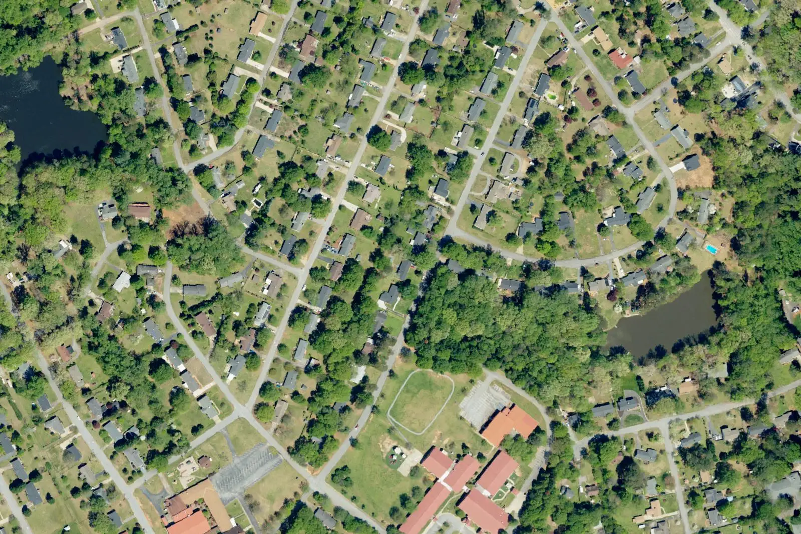
Woodland Heights, on Spartanburg's west side off John B. White Sr. Boulevard, is mostly in ZIP 29301 and split between school districts 6 and 7.
Last checked Oct. 12, 2026. Sources: the City of Spartanburg’s neighborhood association map and 2023 Comprehensive Plan (PDF), Spartanburg County address points, District 7’s attendance zones, the Census Bureau’s school district boundaries, the state’s 2025 school report cards, Zillow Research and OpenStreetMap.
Woodland Heights is a west side neighborhood of mostly single-family houses on both sides of John B. White Sr. Boulevard, along Holly Drive, Briarwood Road, Lanford Road, Arrowhead Circle, Saint James Drive and Gordon Drive. It is the one neighborhood in this guide where most homes are not in Spartanburg School District 7.
What this means for you
- Zoned high school: Dorman High for most addresses (Spartanburg School District 6); Spartanburg High for the rest. Check your address before you enroll.
- Home value: $237,124 in ZIP 29301 in August 2026, according to the Zillow Home Value Index.
- Nearest interstate exit: I-26 exit 21B, US 29 North.
Part of our Spartanburg neighborhoods guide.
Where it is
The city’s neighborhood association map draws Woodland Heights across about 1 square mile, the largest area on the map, and the neighborhood also appears on the neighborhood map in the city’s 2023 Comprehensive Plan. The county’s address file has about 880 residential addresses inside the boundary: 89% in ZIP code 29301 and 11% in 29306. All are inside city limits, so the city provides police, fire and trash service.
Schools
Woodland Heights sits on the line between two school districts. We matched the residential address points inside the boundary to District 7’s zone map, and checked a sample of the rest against the Census Bureau’s district boundaries:
| District | Share of addresses | High school | 2025 rating |
|---|---|---|---|
| Spartanburg School District 6 | 71% | Dorman High, 1050 Cavalier Way, Roebuck | Average |
| Spartanburg School District 7 | 29% | Spartanburg High, 2250 E. Main St. | Average |
- District 7 addresses are zoned for The Cleveland Academy of Leadership (Good) and Carver Middle (Average). Check with District 7’s attendance zone lookup.
- District 6 addresses: Dorman is the one high school District 6 has in the state’s 2025 report card data. District 6 also runs Woodland Heights Elementary, 1216 John B. White Sr. Blvd. (Average), but we could not find a public District 6 zone map, so confirm the elementary and middle school for an address with Spartanburg School District 6.
Ratings are the overall ratings on the 2025 state report cards (the 2024-25 school year), on a scale of Excellent, Good, Average, Below Average and Unsatisfactory. More in our schools guide.
Home values
The typical home value in ZIP 29301 was $237,124 in August 2026, up 1.73% from $233,081 in August 2025, according to the Zillow Home Value Index. The index is a modeled typical value for the middle third of homes, not a sale price, and ZIP 29301 covers much of the west side, inside and outside city limits. The citywide figure was $232,218, up 1.10% on the year. More in our home prices guide.
Parks and trails
OpenStreetMap maps two small parks just outside the neighborhood’s east edge, Carlisle Park and Montgomery Park, in Park Hills. Stewart Park, at 500 Highland Ave. in the Highland neighborhood, has a splash pad and a walking trail. More in our parks guide.
Getting around
- Interstate: I-26 exit 21B, US 29 North toward Spartanburg, about 2.6 miles by road from the middle of the neighborhood, by the exit numbers in OpenStreetMap.
- Downtown: about 2.7 miles by road to Morgan Square.
- Airport: about 18 miles by road to GSP International Airport. Both are distances measured on the OpenStreetMap road network with the OSRM routing engine, not drive times.
- SPARTA: Route 8 (Dorman Centre) runs through the neighborhood in OpenStreetMap’s route data, and Route 7 (Crestview) runs along its edge. See the city’s route list.
More in our getting around guide.
Groceries and everyday stores
From OpenStreetMap, just outside the neighborhood:
- Sunny’s Market, 108 Westview Blvd.
- S&A Discount Grocery, 1600 John B. White Sr. Blvd.
How we drew this area
Woodland Heights’ edges here are the association’s boundary on the city’s 2026 neighborhood association map. School shares come from the county’s residential address points inside it, matched to District 7’s zone map on Oct. 12, 2026; a sample of the addresses outside every District 7 zone was checked against the Census Bureau’s school district map. The aerial photo is USDA imagery. Store and park locations are © OpenStreetMap contributors.
Frequently asked questions
Is Woodland Heights in Spartanburg a good place to live?
Here are the facts. Woodland Heights is the largest neighborhood association area on the city’s map, about 1 square mile on the west side, 2.6 miles by road from I-26. Most of it is in Spartanburg School District 6, whose high school, Dorman, was rated Average on the 2025 state report card, and Zillow put the typical value in ZIP 29301 at $237,124 in August 2026.
What school district is Woodland Heights in?
Mostly Spartanburg School District 6. About 71% of the residential addresses inside the city’s boundary sit outside District 7’s zones and in District 6 on the Census Bureau’s district map; the other 29% are in District 7 and go to Spartanburg High.
What ZIP code is Woodland Heights in Spartanburg?
Mostly 29301 (89% of residential addresses in the county’s file); the rest are in 29306.
What is the nearest interstate exit to Woodland Heights?
I-26 exit 21B, US 29 North toward Spartanburg, about 2.6 miles by road, by the exit numbers in OpenStreetMap.
Have your say