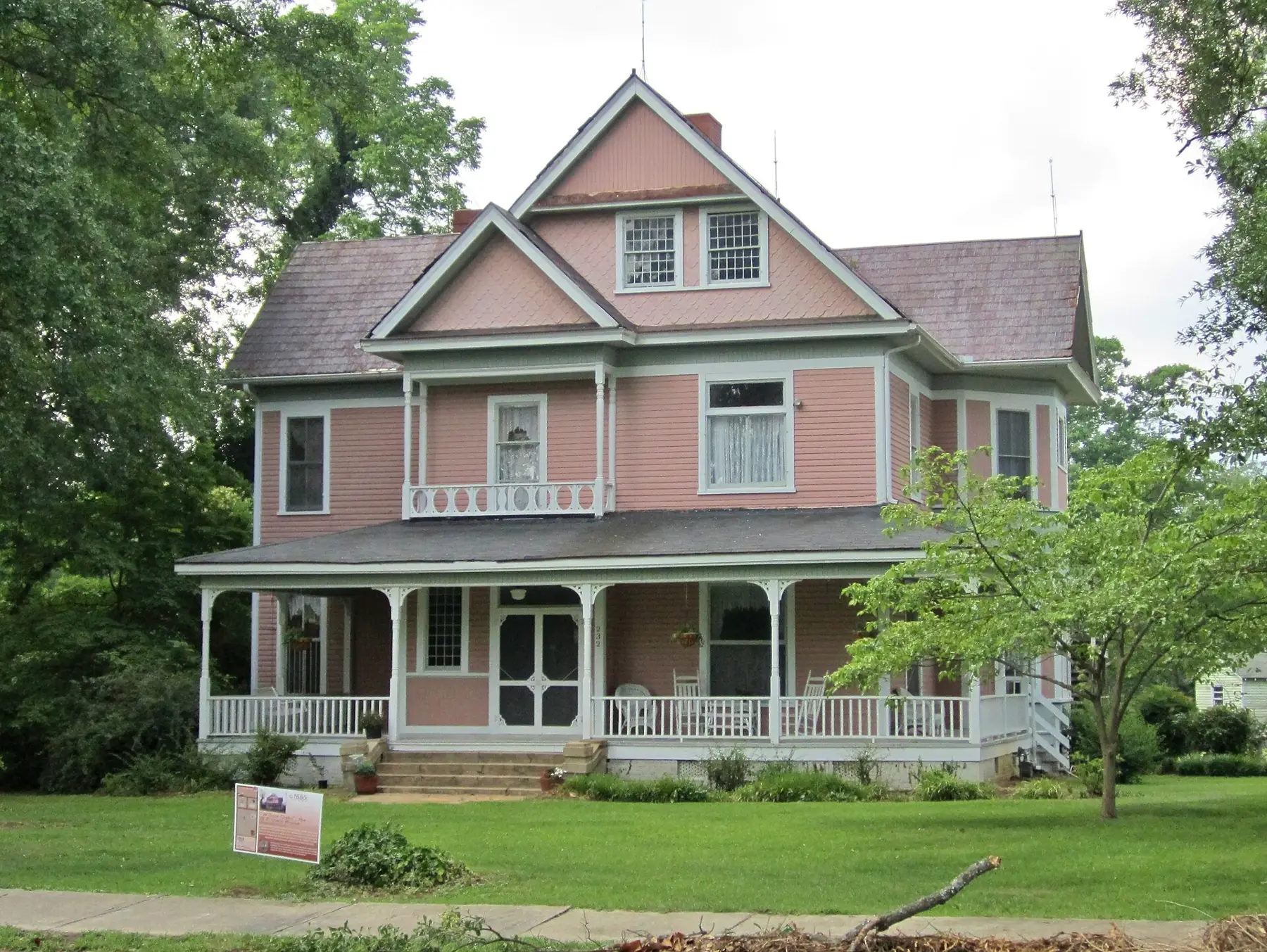
Hampton Heights, a local historic district of 375 homes southwest of downtown, is in ZIP 29306 and zoned for Mary H. Wright, Carver and Spartanburg High.
Last checked Oct. 12, 2026. Sources: the City of Spartanburg’s Historic Districts page and neighborhood association map, the South Carolina Department of Archives and History, Spartanburg County address points, District 7’s attendance zones, the state’s 2025 school report cards, Zillow Research and OpenStreetMap.
Hampton Heights is one of Spartanburg’s two locally designated historic districts, a neighborhood of early 20th century houses just southwest of downtown along Hampton Avenue, Hampton Drive, Irwin Avenue and Morningside Drive. Changes to the outside of a house here need the city’s approval.
What this means for you
- Zoned high school: Spartanburg High, with Mary H. Wright Elementary and Carver Middle. Check your address with District 7’s attendance zone lookup.
- Home value: $194,047 in ZIP 29306 in August 2026, according to the Zillow Home Value Index.
- Nearest interstate exit: I-585 exit 25B, Pine Street.
Part of our Spartanburg neighborhoods guide.
Where it is
The city’s Historic Districts page says the Hampton Heights Historic District includes 375 residences developed between 1890 and 1930, in Queen Anne, Bungalow, Craftsman, Four-Square and Neo-Classical styles. Larger homes have deeper setbacks and mature landscaping; smaller homes built later have narrower lots. The city publishes a district map (PDF).
The district was listed on the National Register of Historic Places on Jan. 27, 1983, the city says. The state’s National Register page counts 120 contributing residences in the area it listed.
Every residential address inside the neighborhood’s boundary on the city’s neighborhood association map is in ZIP code 29306 and inside city limits, so the city provides police, fire and trash service.
The historic district rules
The city’s Historic Architecture and Review Board reviews proposed exterior changes, additions and new construction in the district against its design guidelines. Before you start, read the homeowner guide (PDF) and design guidelines (PDF), then apply for a certificate of appropriateness. Planning: 864-596-2068, 440 S. Church St., 8 a.m. to 5 p.m. weekdays.
Schools
We matched the 389 residential address points inside the boundary to District 7’s zone map. Ratings are the overall ratings on the 2025 state report cards (the 2024-25 school year).
| Level | School | Share of addresses | 2025 rating |
|---|---|---|---|
| High | Spartanburg High, 2250 E. Main St. | 100% | Average |
| Middle | Carver Middle, 467 S. Church St. | 100% | Average |
| Elementary | Mary H. Wright Elementary, 457 S. Church St. | 100% | Average |
The state’s scale runs Excellent, Good, Average, Below Average and Unsatisfactory. The district calls its lookup an unofficial confirmation until you show proof of residence at the school. More in our schools guide.
Home values
The typical home value in ZIP 29306 was $194,047 in August 2026, down 0.24% from $194,517 in August 2025, according to the Zillow Home Value Index. The index is a modeled typical value for the middle third of homes, not a sale price, and ZIP 29306 covers much of the south side, not just Hampton Heights. The citywide figure was $232,218, up 1.10% on the year. More in our home prices guide.
Parks and trails
From the city’s facility pages:
- Willow Oaks Park, 191 W. Hampton Ave.: swings, a playground and a water fountain in a corner of the district (city page).
- Irwin Park, 685 Irwin Ave., just outside the boundary. The city and the nonprofit PAL are asking residents for ideas on revitalizing it and held a drop-in meeting Feb. 18, 2026 (city page).
- Hub City Art Park, 209 S. Daniel Morgan Ave., next to the district’s north edge.
More in our parks guide.
Getting around
- Interstate: I-585 exit 25B, Pine Street, about 3 miles by road from the middle of the district, by the exit numbers in OpenStreetMap.
- Downtown: about 1.3 miles by road to Morgan Square.
- Airport: about 20 miles by road to GSP International Airport. Both are distances measured on the OpenStreetMap road network with the OSRM routing engine, not drive times.
- SPARTA: in OpenStreetMap’s route data, Route 7 (Crestview) runs along the district’s edge, and Routes 4 (South Church Street) and 6 (South Liberty Street) pass within a few blocks. See the city’s route list.
More in our getting around guide.
Groceries and everyday stores
OpenStreetMap shows no supermarket inside the district. Smith’s Drug Store, 142 E. Main St., downtown, is about a third of a mile from its edge.
How we drew this area
Hampton Heights’ edges here are the boundary on the city’s 2026 neighborhood association map, which closely follows the city’s GIS outline of the local historic district. School shares come from the county’s residential address points inside it, matched to District 7’s zone map on Oct. 12, 2026. Store and park locations are © OpenStreetMap contributors.
Frequently asked questions
Is Hampton Heights a good place to live?
Here are the facts. Hampton Heights is one of the city’s two local historic districts, with 375 homes built mostly between 1890 and 1930, about 1.3 miles from Morgan Square. It is zoned for Mary H. Wright Elementary, Carver Middle and Spartanburg High, each rated Average on the 2025 state report card, and Zillow put the typical value in ZIP 29306 at $194,047 in August 2026.
Do I need permission to change my house in Hampton Heights?
For exterior changes, additions and new construction, yes. The city’s Historic Architecture and Review Board reviews them against its design guidelines, and you apply for a certificate of appropriateness through the Planning office, 864-596-2068.
What schools is Hampton Heights zoned for?
Mary H. Wright Elementary, Carver Middle and Spartanburg High, for every residential address in the city’s neighborhood boundary, based on District 7’s zone map.
When was Hampton Heights listed on the National Register?
Jan. 27, 1983, the city says.
Have your say